In the intricate tapestry of land, air, and water, lies the foundation of our world’s landscapes. Understanding these terrains with precision is not just a necessity but an art. At Bill Carr Surveys, we don’t just map; we sculpt the very essence of the earth’s topography, utilizing cutting-edge technology and expertise.
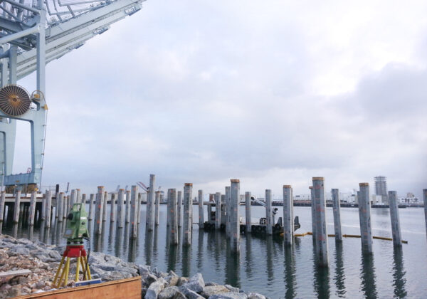
Unveiling the Landscape: Total Station Instrumentation stands at the forefront of our terrestrial mapping endeavors. With unparalleled accuracy and efficiency, this instrument captures the essence of the land, contour by contour. Whether it’s a sprawling urban jungle or a remote wilderness, our Total Station Instrumentation eaves no stone unturned, ensuring every detail is meticulously recorded.
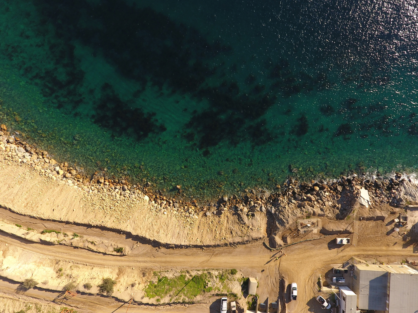
Taking Flight: Aerial mapping drones elevate our mapping capabilities to new heights, quite literally. With a bird’s eye view, we transcend traditional limitations, capturing vast expanses of land with unrivaled precision. Equipped with state-of-the-art sensors and cameras, our drones navigate the skies, transforming aerial imagery into intricate topographic maps that redefine spatial understanding.
Exploring Beneath the Surface: Water-based mapping presents its own set of challenges, yet with lead-line soundings, we dive into the depths with confidence. From serene lakes to turbulent rivers, our soundings reveal the hidden contours of underwater landscapes, providing invaluable insights for navigation, conservation, and development projects alike.
Precision in Practice: At Bill Carr Surveys, precision is not just a goal; it’s our standard. With a blend of technological innovation and seasoned expertise, we deliver topographic maps that transcend expectations. Our maps serve as blueprints for a myriad of applications, from urban planning and infrastructure development to environmental conservation and resource management.
Beyond the Map: Our commitment extends beyond just mapping; it’s about empowering our clients with actionable insights. Whether it’s optimizing land use, mitigating environmental impact, or enhancing safety measures, our topographic maps serve as the cornerstone for informed decision-making.
Conclusion: In the realm of topographic mapping, precision is paramount. At Bill Carr Surveys, we don’t just map the world; we redefine it. Through a harmonious blend of cutting-edge technology and unwavering dedication, we illuminate the intricacies of our planet’s landscapes, one contour at a time.